
NEPTUNE INTERNATIONAL WORKSHOP, BUDAPEST 2007
Touch the water: riverside development of Budapest
Through its history, Budapest was always determined by the River Danube. In the Roman area, it was the borderline of the empire. Later on, the early settlements of the medieval periode were founded at the narrowest section of the river. Pest and Buda, separated by the river was two different town until 1873, when with Óbuda they were integrated into one administrative unit. There was not even a bridge across the River Danube until 1849 when the Chain Bridge opened.
Floods caused considerable demage during the centuries. After the bigest destruction, in 1838, when almost the whole of Pest was under water, the authorities ordered the construction of the levies on the two sides of the river to avoid such disasters in the future. Though floods of today are higher and higher, the upper part of these levies are still safe.
In 19th century, Budapest as the largest river port of the Danube, became an entrepôt for raw materials, like timber and grain, and was where the products were processed, stored and sold. According to some estimates, it was the world’s second largest centre of milling industry early the 20th century. This transformed the south part of the Pest’s side into wharves. Some of the warehouses are still present though without proper functions, as the agricultural and heavy industry have melted away after the political changes. Since then the citie’s economy is mainly based on the service sector.
After the 1990’s, significant projects have started in the south of Budapest. On the Buda side, connecting to the university campus, offices and research centers of informatics companies, on the Pest side, the new Millenium City Center with cultural institutions like the Palace of Art and the National Theater. Still, these projects have nothing to do with the river. A recent project is a new university building in the back of the warehouses.
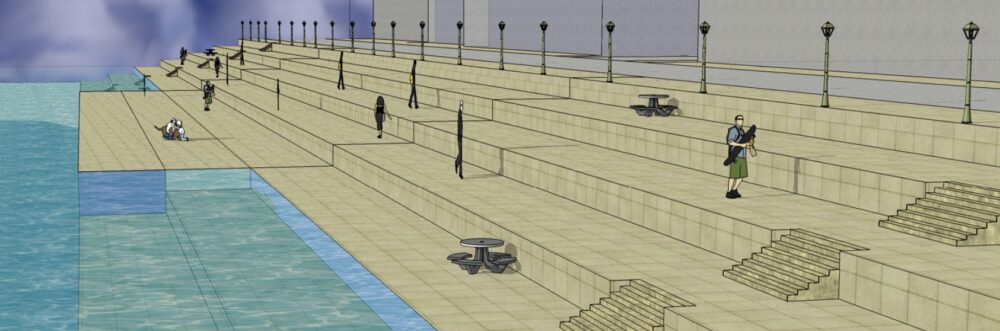
By the end of the 20th century the Danube, with its concrete sides became a canal of circulation. Traffic jams in the rush hours, docks for tourist boats, inexisting pedestrian connection to the city center on both side cuts the river off the city. Despite the bridges the river has become once again a borderline.
The aim of this workshop is to analyse the current situation and to find solutions how to connect the city with its river once again. The questions and aims are the following: – the reconstruction of the three main square, Ferenciek tere (Elisabeth Bridge), Fővám tér(Liberty Bridge) and Boráros tér (Petőfi Bridge), considering them as public spaces and interchange, solving the parking difficulties – restructuring the public transport and the circulation on the side of the river – finding new functions for the warehouses – creating a system of public spaces along the river, connecting it with the main squares and the park, giving a proper entrance for the new university building
| GROUP 1 – Ron Neuman, Irene Catana, Thomas Ligthart, Lydia Simons, Benjamin Bouvier; Supervisor: Barbara Cantalini FINAL PRESENTATION IN PDF |  |
| GROUP 2 – Paola Antonangelo, Anthony Meloni, Rinko Dijk, Borbála Utasi, Daniel Williams; Supervisor: Johannes Boonstra FINAL PRESENTATION IN PDF |  |
| GROUP 3 – Gergely Szalay, Mariateresa Bologna, Markus Yan Wijning, Victoria Wright, Karim Almoudane; Supervisor: Christopher Young FINAL PRESENTATION IN PDF |  |
| GROUP 4 – Zsuzsanna Vrana, Carmen Brunetti, Peter Vredeveld, Ryan Oakley, Nicolas Jacquart; Supervisor: Dominique Saintive FINAL PRESENTATION IN PDF | 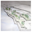 |
| GROUP 5 – Judit Szirmay, Rob Koningen, Vincenzo De Paolis, Julien Brule, Sarah Foster; Supervisor: Judit Rab FINAL PRESENTATION IN PDF | 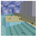 |
| GROUP 6 – Piebe de Jong, Craig Allsop, Isabelle Berthe, Andrea Colantonio; Supervisor: Judit Skaliczky FINAL PRESENTATION IN PDF | 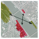 |